Create Saved Search Links for Areas That Are Not a City
Search links for a neighborhood, district or local name your MLS does not carry, drawn as a polygon in IDX Broker.
Written by IDX Plugin, an independent IDX Broker Developer Partner, not affiliated with IDX Broker.
On this page
In short
- Build a search link for a neighborhood, district or local name.
- Draw the area once and the link returns the listings inside it.
- Skip drawing: describe the area to AI and paste the line in.
- One saved link works behind a tile, a menu item or a text link.
Almost every agent website has a "Search by area" section: a row of tiles, each one opening a ready search. Behind every tile is a saved search link. A town or a ZIP code is easy, because the MLS carries those values and you pick them from a list. A neighborhood, a downtown district, a corridor along one road or a name only locals use is not in that list, and those are the names people type into a search box. Polygon search covers them: you draw the area on a map, and the saved link returns everything inside the shape.
Decide how the area should be defined
First check whether the area already exists as a value in your account. A filter on a real MLS field updates itself and needs no maintenance, so it beats a drawn shape whenever it is available.
| What the area is | How to build it |
|---|---|
| An incorporated city or town | City filter |
| A postal area | ZIP code filter |
| A subdivision the MLS lists by name | Subdivision filter |
| A neighborhood, district, corridor or local name | Map polygon |
| An area smaller than one ZIP code | Map polygon |
Draw the area in IDX Broker
-
1
Open Saved Links and create a new one
In your IDX Broker account, open Saved Links and click Create Link. This is the same screen that holds every ready search you have already built.

-
2
Pick a search page from the Polygon group
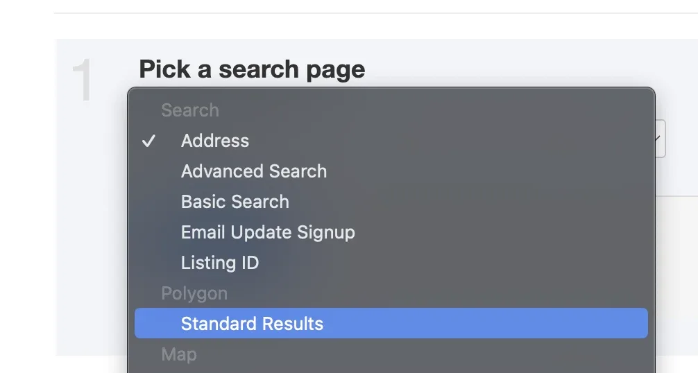
The first step of the wizard asks which search page to use. Open the dropdown and look past the plain Search entries: there is a Polygon group, and picking a page from it is what turns on the map drawing tools. Standard Results is the usual choice. Then click Next Step.
-
3
Draw the shape on the map
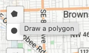
The next step shows a map with drawing tools in the top left corner. Choose the polygon tool, then click once for each corner of your area. Follow real edges where you can, such as a highway, a river or a city limit.
-
4
Close the shape
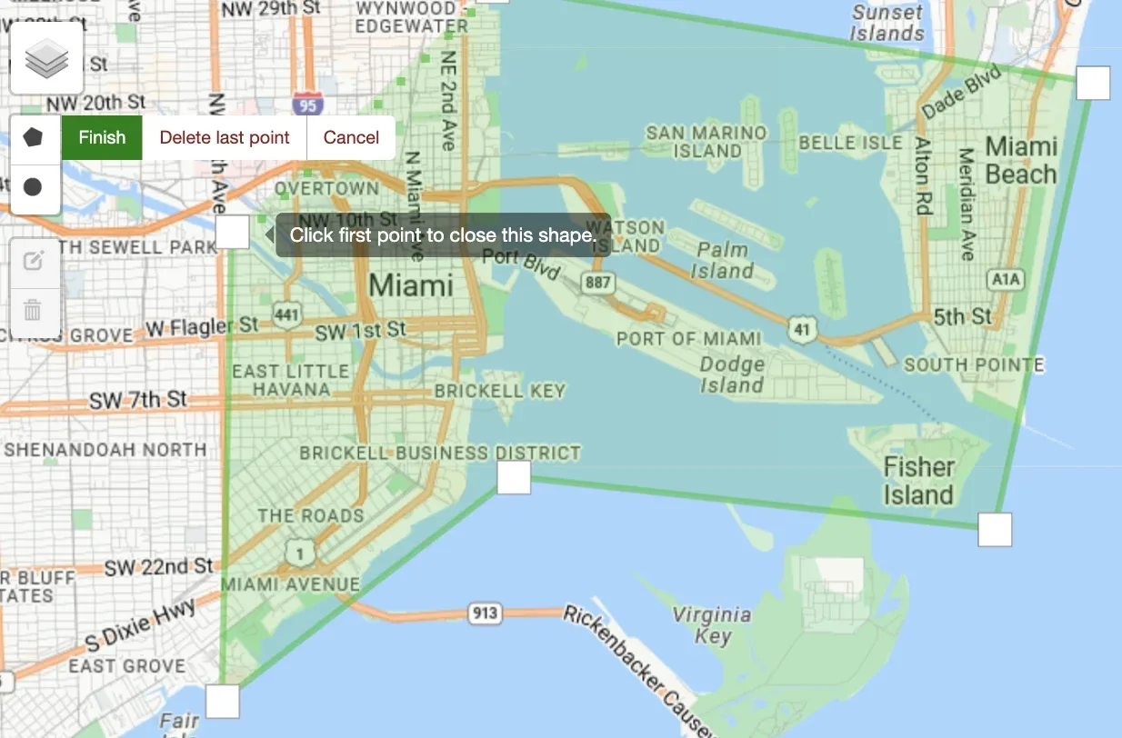
Keep clicking corners until you are back where you started, then click the first point again to close the shape. The map will tell you to do this. An unclosed shape is not a polygon and will not filter anything. When the area is filled in, click Next Step.
-
5
Name it and save
Give the link a Page Title. Use the area name exactly as it will appear on the website. Save, and the link is ready to use anywhere on your site.
Paste a polygon you already have
If you already have the coordinates, from a previous setup, a mapping tool or an AI assistant, you can paste them in instead of drawing. Open the saved link and click the magnifier icon on its row, which opens Edit Search Criteria.
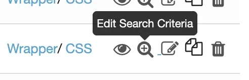
Inside, switch to the Edit Link By Hand tab. This is a plain text field holding the whole query behind the saved link. A working polygon query has this shape.
pgon=25.7400+-80.2100,25.7530+-80.2145,25.7660+-80.2155,25.7790+-80.2085,25.7900+-80.2040,25.8000+-80.2000,25.8100+-80.1930,25.8115+-80.1700,25.8125+-80.1450,25.8120+-80.1240,25.8060+-80.1210,25.7950+-80.1235,25.7840+-80.1270,25.7730+-80.1295,25.7660+-80.1320,25.7700+-80.1520,25.7640+-80.1720,25.7530+-80.1830,25.7440+-80.1900,25.7400+-80.2000,25.7400+-80.2100&radius=&layerType=polygon&clat=25.7760&clng=-80.1680&zoom=12&pt=1&srt=newestThat exact line sits in a saved link on our demo account, so you can open the test link and see how it came out. It covers downtown Miami, Brickell, Edgewater and South Beach, and its outline has twenty points, plus the first one repeated at the end, because the edges follow I-95, the causeway and the ocean. Your own line keeps the same format, with your own points.
Get the coordinates from AI
Instead of drawing every area by hand, describe each one to an AI assistant and ask for the coordinates in the format above. How close the shape lands depends on how specific your description is, so name the roads, the landmarks and the edges you do not want crossed.
I need a polygon for an IDX Broker saved search link.

Area: [area name, the town and state it belongs to, the roads or
landmarks that define its edges, and anything it must not cross]

Return one single line in exactly this format and nothing else:

pgon=LAT+LNG,LAT+LNG,...,LAT+LNG&radius=&layerType=polygon&clat=LAT&clng=LNG&zoom=12&pt=1&srt=newest

Rules:
- follow the real edges of the area, in clockwise order
- repeat the first point as the last point so the ring is closed
- latitude first, then a plus sign, then longitude (longitude is negative)
- commas between points, no spaces anywhere in the line
- set clat and clng to the center of the shape
Paste the line the assistant gives you into Edit Link By Hand and save. For the next area you change only the description block at the top and keep the rest of the prompt as it is.
Check the result before you use it
Open the finished link and check two things. First, the shape sits where you expected. Second, it returns listings, because a tile that opens an empty result page is worse than no tile at all. If the result comes back thin, widen the shape or drop that area from the list.
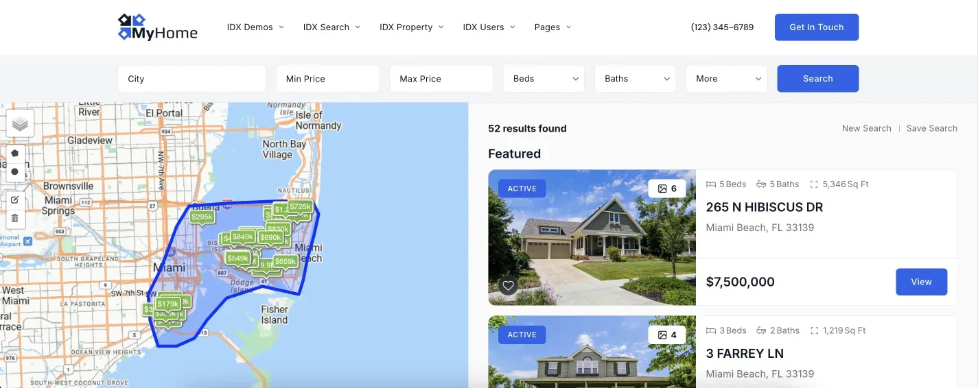
Once a link is saved it is simply a URL, so it works behind an area tile, an image card, a menu item or a text link, on any platform. Nothing else on the site needs to change.
Send us your area list and we will build it
Give us the names of the areas you want on the site and we will create the saved links, draw anything that needs a polygon, and place the tiles on your pages. It is part of the free service.
Contact Support Or email support@idxplugin.com